The northern line includes five stations: Riyadh, Majma’ah, Qassim, Hail, Al Jouf, and Qurayyat. It begins in Riyadh City, extends northwest toward Al Majma’ah City (southeast of Buraydah), passes through the regions of Qassim (northeast and closer to Buraydah), Hail, and Al Jouf, and is now partially in service from Riyadh-Qassim-Hail.
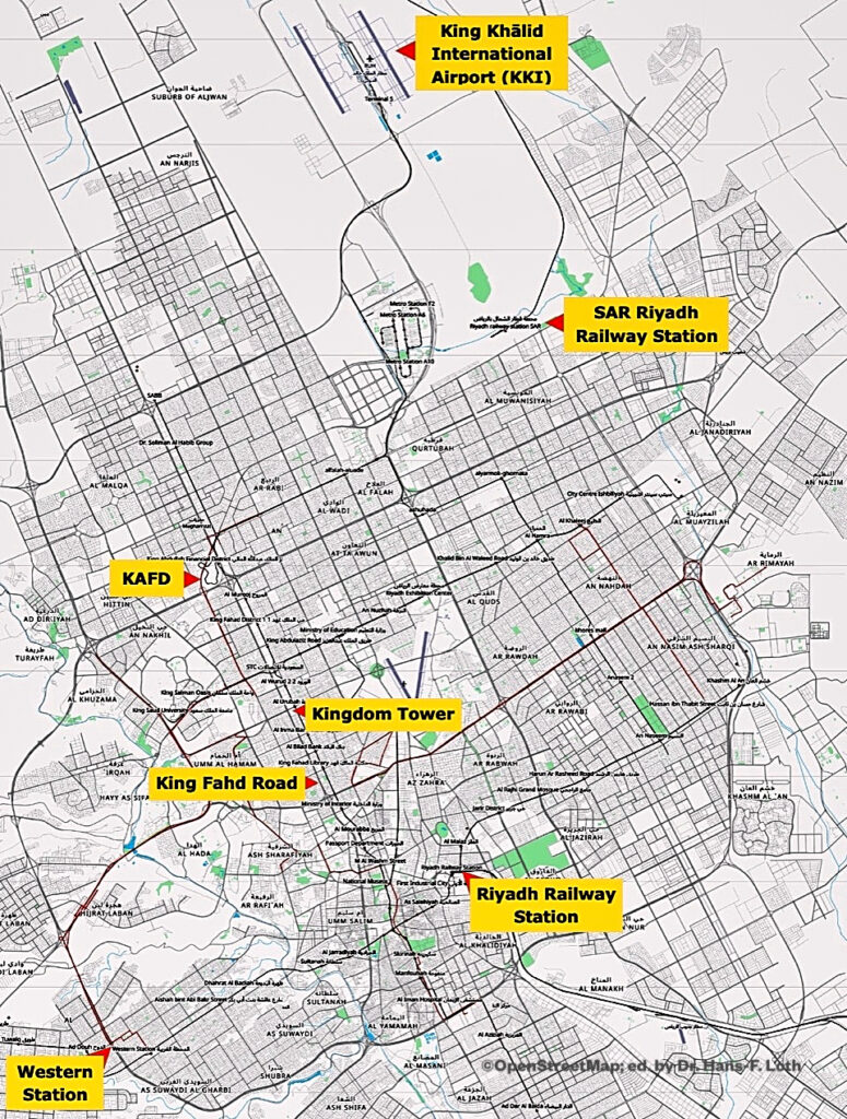
Address: 3612 King Khalid Airport, Unit 1, Riyadh 13422 – 7032, with GPS coordinates 24.855658, 46.764703. On the previous map it is marked as a station near the airport.
The eastern line operates between Riyadh and Dammam via Al Hofuf and Abqaiq. According to the SAR website, the first line has a length of 733 km (455 mi). The second line, 556 km long, is dedicated to freight transport. It starts at King Abdulaziz Port in Dammām and ends in Riyadh, passing through Abqaiq, Al Hofuf, Al Kharj, Haradh and Al Tawdhihiyah. A one-way ticket from Riyadh to Dammam in first class costs SAR 290.00 per adult (as of Nov. 2022).
Address: 12844 Omar Ibn Al Khattab Road, 12844 Hasan Alshawri, Riyadh with GPS coordinates 24.651348, 46.738834. It is shown as a valley station on the previous map.
Metro
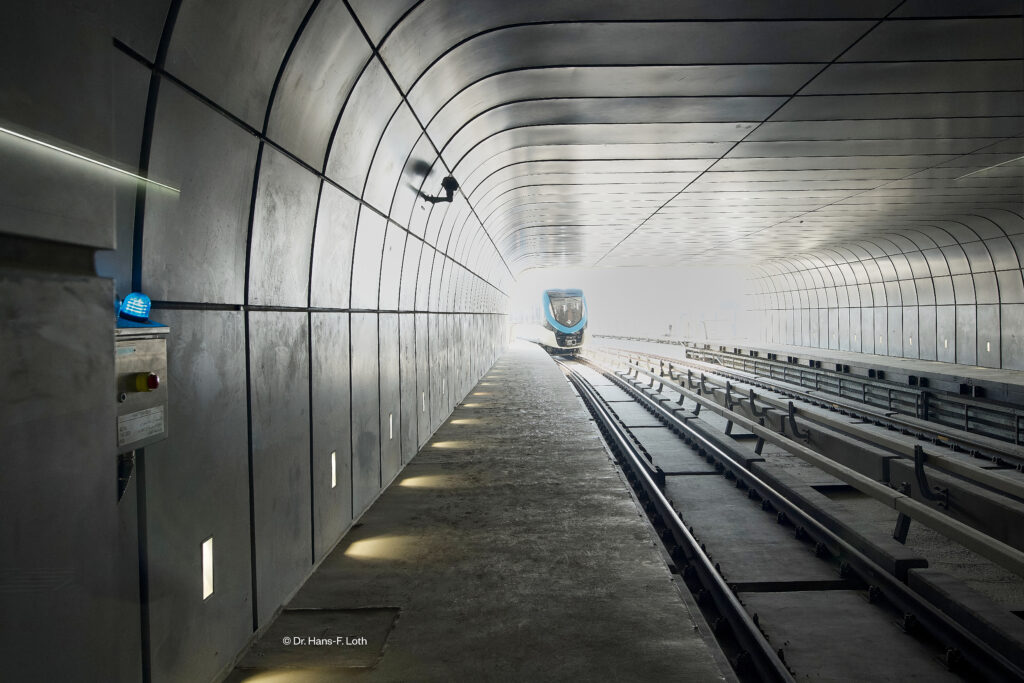
Following several years of delays, the first six main lines have been in operation since late 2024, with the network continuing to be significantly expanded to meet the transport needs of the rapidly growing Metropolis. As of now (early 2026), the metro network spans 176 kilometres and comprises 85 stations, served by driverless trains running at frequent intervals of 3–5 minutes. Every visitor to Riyadh should take a metro ride at least once; tickets are very affordable (at least by European standards) and have quickly gained widespread acceptance among the population. Well over 1 million passengers now use the metro every day. According to the metro authority, the lines cover most populous districts, government institutions, educational and commercial facilities. It is connected to King Khaled International Airport and King Abdullah Financial District, as well as major universities, the city center and the public transport hub. Users can expect state-of-the-art technology and highly aesthetic architecture of all stations. The network can be seen in the graphic below.

The Blue Line is the network’s main north-south line and currently runs from the King Abdullah Financial District (KAFD) in the north to well beyond Qasr Al Hukm in the south. The Blue Line, effectively the backbone of the network, is packed during the morning and evening rush hours, even in first class – there is virtually no difference compared to the London Underground.
The Red Line runs east-west along King Abdullah Road. It stretches over 24.2 km and comprises 15 stations.
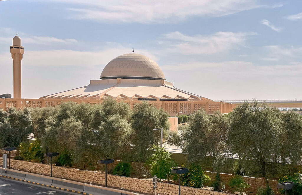
Orange Line: This is the longest route, stretching over 40.7 km along Al Madinah Al Munawarah Road. It has 22 stations, including one at the grand Al Rahji Mosque. Key stops include Western Station and Jeddah Road. This line connects the east and west of Riyadh. Qasr Al Hukm station is the interchange with the Blue Line.
The Yellow Line, approximately 30 km long, provides a connection to King Khalid International Airport. It has 9 stations. The most important stops include Airport Terminals 1, 2 and 5, as well as KAFD in the west.
The Green Line crosses the cultural centre of Riyadh along King Abdulaziz Road. Among the most important of the 12 stops is the National Museum. The line’s significance will increase further once the huge King Salman Park is completed.
The Purple Line serves the Eastern Link over a distance of approximately 30 km along Abdurrahman Bin Awf Road, extending to KAFD in the west. Via the Al Hamra Station interchange, it connects the eastern districts with the city centre.
Operating hours are daily from 6.00 am to midnight, and on Fridays from 8.00 am to midnight.
Tickets are affordable. A 7-day pass costs SAR 40.00 standard, or SAR 100.00 in first class.
The DARB APP provides a good overview of the lines and the network.